In the fall of 2005, DEP's Harbor survey vessel Osprey was also fitted with a cell modem, and this same Web page can be used to show Osprey's data and paths.
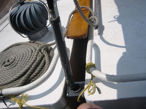
| The sonde, a YSI 600XL, is shown here dangling above the open end of a 2" PVC pipe, into which it just fits. In turn, the pipe (about 8' long), just fits into Pioneer's centerboard well, forward of the centerboard. The board has circular curvature around its pivot point near the lower forward corner, so the PVC pipe doesn't get in the way of the centerboard no matter how far it's raised or lowered - clearance less than .5", a small miracle! |
| The sonde is now in place at the bottom of the PVC pipe; the probes are about 1.5' below the surface. Note the cable's passing through the forward wall of the galley, emerging in the next picture... |
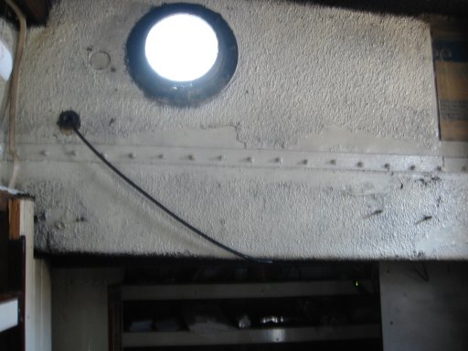
| Looking forward in the galley, we see the data/power cable from the sonde entering and running starboard to connect with 12 V DC power and to the cellphone modem. |
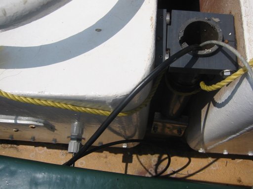
| The black cable from the sonde (running into this picture from the upper right) connects to a white computer serial cable (standard DB-9), and also to a 12 V DC power source. The galley lights DC circuit includes the female "cigarette lighter" style power socket, into which is plugged a 2-way splitter. One male plug carries 12 V to the sonde cable, which brings power to the sonde; the other male plug (barely visible on the shelf) brings 12 V DC to the cellphone modem. Starting Pioneer's engine often causes a power dip sufficient to reset the modem and sonde, and occasionally a manual reset is needed to bring the sonde back on-line (though usually it is automatically reset properly by the data-gathering software at Stevens Institute of Technology). |
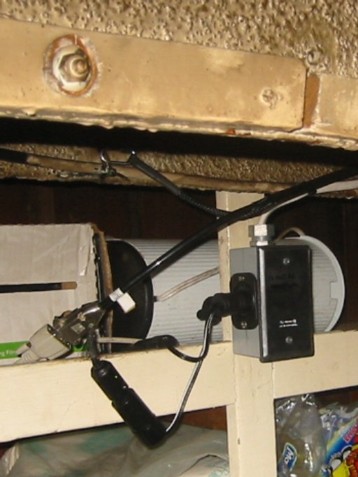
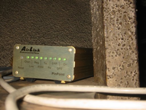
| The cellphone modem is an Airlink PinPoint, with built-in GPS function as well as Internet capability. Through a wireless account with Verizon, the modem receives an Internet IP address, and sends and receives data and instructions (to both modem and sonde) over the Internet. |
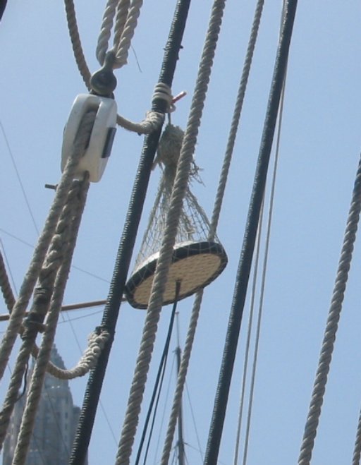
| From the PinPoint modem below deck, antenna wires pass up through a (preexisting) through-deck, (another miraculous example of Pioneer's cooperation!), to the antenna pictured here, which receives GPS satellite signals, and separately broadcasts and receives Internet packets over the cellphone wireless network (a Verizon account, roughly $80/month). Coverage throughout the NY Harbor area seems pretty reliable, as does GPS reception.) |
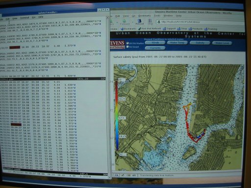
| The data transmitted from Pioneer is received by computers at Stevens Institute, where it is stored in databases, and also rendered in real time into Web pages like this, which show the Pioneer's path, with different colors showing the values of a user-selected water measurement parameter (here, salinity). The path shown is that taken on 6/22/2005, for a press conference sail to officially inaugerate the data-taking program. The Web site is at Stevens Institute's Web site; the visitor can select a data and time range to view. At present (December 2005) the modem is back at Stevens, so that's the location shown til Pioneer's refitting next Spring. In the fall of 2005, DEP's Harbor survey vessel Osprey was also fitted with a cell modem, and this same Web page can be used to show Osprey's data and paths. |